This post is also available in:
![]()
![]()
![]()
![]()
![]()
![]()
Online history of grazing routes to remember and improve grazing routes in the next year
Solution name: Online history of grazing routes to remember and improve grazing routes in the next year
Aim: Improve grazing routes, remember points of interest in the grazing routes, remember best grazing grounds for next year, cooperate with other farmers grazing in the same region.
Description:
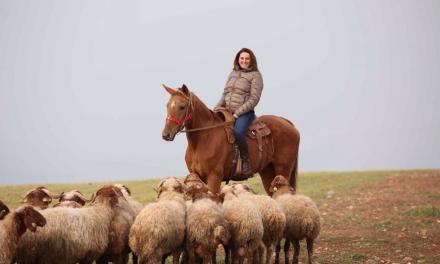
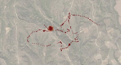
Documenting and logging grazing routes and spots can be an important tool to improve both the herds productivity as well as the sustainable management of the grazelands. Overgrazing in a region can have an adverse effect on its quality as well as the quantity of the biomass, the soil erosion and the other animals that depend on the area. In areas grazed by several flocks sometimes it is very difficult to communicate a common management of grazing areas. Functional changes on the routes and grazing areas throughout the year and between years can be possible if there is a visualised “history” of the previous movements for each flock. Modern, low cost and easily accessible equipment can be used to visualize and manage grazing routes and areas.
Topic: Nutrition
Production: Dairy/meat
Animal Category: Adult/replacements/lambs
Issue: Grassland and grazing management
Level of Solution: Knowledge, Practical
Country: Greece
How to implement it
GPS (Global Positioning System) technology can be utilised either through commercial animal tracking equipment (for example GPS collars) on grazing animals, a smartphone on the farmer accompanying the animals or even home-made collars using cheaper GPS tracking devices (for example car tracking devices). Depending on the device used, the routes can be transferred on online maps either automatically in real-time using mobile sim cards (gprs), or after the flock has returned to the farm, by using a computer or tablet. After importing the routes on an online map, the different maps of the different flocks can be combined on a common one. Additionally, each farmer can pinpoint locations of interest on their route, such as water sources, resting areas, possible dangers, areas with good vegetation etc.
Expected benefits
Better grazing management, improved grazing areas, multi-flock management and cooperation.
Cost Benefit analysis
The extra costs involving the purchase of a smartphone or the possible communication costs are small and in most cases the farmers already have both. The extra time needed for the farmer to learn the technology is negligible. The use of the technology can potentially cover the costs and increase the income by improving the grazing routes of the flock.
Sustainability analysis
The technology brings no additional consumption of fuel, electricity, water etc. and thus having no negative environmental impact. The use of the method can potentially improve the productivity of the flocks by improving the grazing efficiency.
Besides improving the grazing efficiency of the flocks, the monitoring of the grazing routes and cooperation between farmers grazing in the same area can have positive environmental impact on the area. The landscape can be better utilised by the different flocks to minimise the negative grazing impact on soil and local biodiversity. Data on grazing routes from former years can also be used to better plan the present grazing routes considering the landscape protection and efficient use of the resources. Planned management of water sources in grazing areas is also possible to minimise water scarcity.
Prerequisites and/or limits
The farmer’s basic understanding of the technology used could be a limit, but can be easily taught. At least a smartphone with GPS technology is required, which is common even on the cheapest ones.
